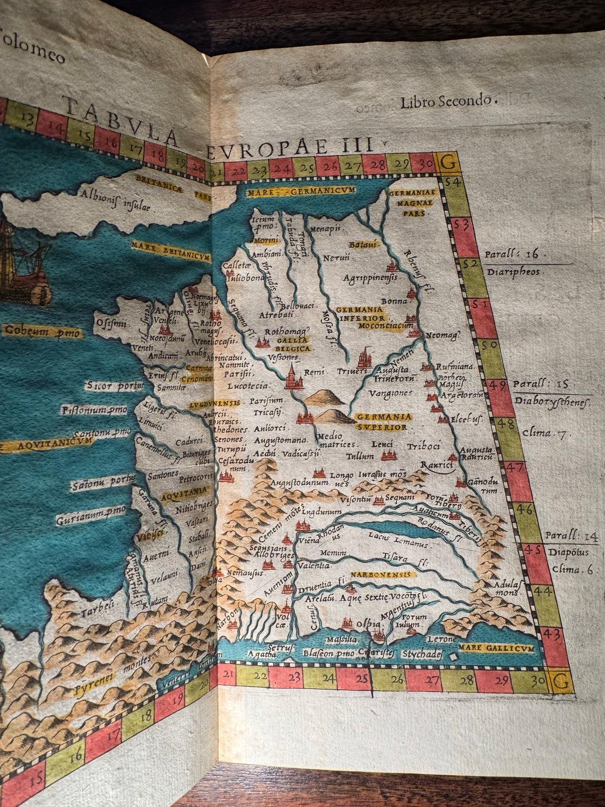
An impressive original 16th-century copper-engraved map of ancient Gaul and the surrounding regions, published in Venice in 1599 as part of the celebrated geographical tradition of Claudius Ptolemy.
Titled Tabula Europae III, the map depicts much of modern-day France together with portions of the surrounding European landscape. Rivers, mountain ranges, cities, coastlines, and ancient regional names are rendered throughout the map, offering a fascinating Renaissance interpretation of Ptolemaic geography.
Of particular interest are the decorative elements within the Atlantic: a beautifully rendered sailing ship appears off the northern coast, while a large sea creature or sea monster swims farther south. Such creatures are among the most captivating features of early European cartography and reflect a period when geographical knowledge, classical authorities, travelers' accounts, and artistic tradition intersected on the printed map.
The map comes from the 1599 Venice edition associated with Girolamo Ruscelli, Giuseppe Rosaccio, Giovanni Antonio Magini, and the geographical works of Ptolemy. It was produced by copper engraving and has been enhanced with attractive later hand coloring, including vivid blue seas and colored geographical and decorative details.
A wonderful piece for collectors of early cartography, Renaissance printing, maritime history, Ptolemy, or historical depictions of sea monsters and legendary creatures.
Details:
• Date: 1599
• Place of publication: Venice, Italy
• Title: Tabula Europae III
• Cartographic tradition: Claudius Ptolemy
• Associated with: Ruscelli / Rosaccio / Magini
• Technique: Original copper engraving
• Color: Later hand coloring
• Subject: France / ancient Gaul and surrounding regions
• Decorative features: Sea monster and sailing ship
• Overall dimensions: Approximately 34 × 25 cm (13.4 × 9.8 in.)
• Condition: Very good antique condition with expected signs of age; please examine all photographs carefully.
This is an authentic 16th-century printed map dating to 1599—not a modern reproduction.